The History of U. S. Cities (Review - 10 minutes)
Choose a historical starting point to discuss the
relationships between urban planning, transportation and
the development of modern cities. This can be looked at
through historical markers in World or U. S. History. For
example:
• From Trails to Roads -
Discuss the development of road infrastructure between the
13 colonies and the mid and late 1600s
•
The Horse Drawn Carriage - when was the horse drawn
carriage used primarily in the United States? What kinds of
road modifications were necessary for these new vehicles.
How long did it take to travel between major cities like
Boston and New York in a carriage?
• The
Locomotive and Manifest Destiny - At the beginning of the
19th century, rivers, canals and horse-drawn coaches were
the options for moving people and goods within the country.
Railroads enabled an efficiency and carrying capacity that
had never been seen before. They linked different parts of
the nation, carrying people, raw materials and agricultural
products. The "Best Friend of Charleston, " the first steam
powered train, carried 141 people six miles on its initial
run in 1830.
• Robert Fulton’ s
Steamboat - The Steamboat changed how waterways were
used. Rivers like the Hudson became transport and trade
corridors allowing people to travel longer distances in a
shorter amount of time.
• The Model T -
by the early 1900s Ford’ s Model T had changed the
transportation industry making the ownership of a car
affordable and possible for many Americans.
•
The Highway - By the 1950s Highways had stretched
across all 50 states - how did the highway system
increase and encourage car usage?

Highways were a
mojor innovation in the way we transport goods and persons,
though we may see the design of highways as very common
today.
Choose some historical events to discuss and help
students better understand the roles of urban planners and
designers. Urban, city, and town planning integrates land
use planning and transport planning to improve the built
and social environments of communities. If possible, ask a
local urban planner to come visit your classroom and talk
about what he/she does.
Discuss the urban planner’ s
role as a designer and as a liaison between architects,
city officials and citizens. What kinds of issues do you
think they deal with on a daily basis and throughout their
service to a town or city? In many ways, urban planners
must be excellent listeners, considering the needs of local
citizens while balancing the needs of businesses, industry
and our environment.
End your discussion by asking how
urban planning is connected to the word sustainability or
the environment? How do these two concepts intersect?
Explain that urban planning is intimately concerned with
the natural and built (or man-made) environment. In many
ways, almost all of the jobs and decisions a city or urban
planner makes is related to the environment because our
roads affect water quality, air quality, climate change and
land-use among many other environmental issues. For
instance, every time we use a car that needs gasoline or
other fossil fuels, we are discharging emissions and
greenhouse gases into the air. When new roads and highways
are built, vast amounts of natural resources are consumed
and habitats are compromised.
To enrich this lesson, look
at the Smithsonian’ s past exhibition, “
On the
Move ” which chronicles the history of
transportation in the United States complete with excellent
online learning resources that provide activity ideas and
images for students to look through.
As a great
research extension assign teams of students to investigate
one time period covered by the exhibition:
1.
Transportation in America: Before 1876
2. Community
Dreams: Santa Cruz, California, 1876
3. Delivering
the Goods: Watsonville, California, 1895
4. A
Streetcar City: Washington, D. C. , 1900
5. People on
the Move
6. The Connected City: New York, New York,
1920s
7. Crossing the Country: Somewhere in Wyoming,
1903
8. Americans Adopt the Auto
9. Lives on
the Railroad: Salisbury, North Carolina, 1927
10. The
People’ s Highway: Route 66, 1930s- 1940
11. Roadside Communities: Ring’ s Rest, Muirkirk,
Maryland, 1930s
12. Family Camping: York Beach,
Maine, 1930s
13. On the School Bus: Martinsburg,
Indiana, 1939
14. Suburban Strip: Sandy Boulevard,
Portland, Oregon, 1949
15. City and Suburb: Chicago
and Park Forest, Illinois, 1950s
16. On the
Interstate: I-10, 1956- 1990
17. Transforming
the Waterfront: San Francisco and Oakland, California,
1960- 1970
18. Going Global: Los Angeles,
2000
Making it Local (10 minutes -
Investigate)
After discussing some historical
connections, investigate local urban planning and design
initiatives in your area. What is the history of the road
and transportation infrastructure in the area? Is
there a train station nearby? Subways? Just highways? Are
there any future plans?
Use local maps to discuss how
design and transportation affects your local community.
Make sure to present this from the student’ s
perspective - perhaps as a passenger in a vehicle, as
a bike rider or pedestrian. Is it easy for you to walk from
home to school? To downtown or a local market? Why or why
not?
Make a list of local transportation
concerns on the board. Encourage each student to write down
a story about getting around the local neighborhood or
community. What is it like traveling to and from school,
from sporting practices to friend’ s homes? Have each
student write down one story about traveling. Ask each
student to share their stories by talking with a partner
and creating maps of their journey that helps to illustrate
the story.
As a research extension, ask each student to
conduct some individual research about the region. Each
student or group of students should begin by investigating
local information about major transportation projects and
considering the modes and needs for transportation in the
area (ie. Local access roads, farm to market roads,
interstates, public transportation for commuting, bike
lanes etc. ).
Environmental Impacts (5-10 minutes -
Frame/Reframe)
After delving into local issues,
take this opportunity to divide students into design teams.
Have each team begin thinking about their findings from the
previous discussion or research they conducted. Discuss
with students some of their stories about moving around the
region. Can you begin to see any patterns or relationships
emerge? Problems or solutions with the transportation
system in your area?
Ask students to consider some
environmental impacts that are current problems facing many
communities around the country:
• Air
Quality - Cars contribute a great deal of air
pollution to a community.
• Greenhouse
Gases/Climate Change - Most cars use petroleum based
fuels which consume fossil fuels and release greenhouse gas
emissions into the air.
• Land Footprint
- Roads, highways and other infrastructure fragment
habitats and natural areas like swamps, meadowlands and
other fragile ecosystems.
• Water Quality
- Runoff from roads impacts water quality nationwide.
After talking about these issues, relate them to your own
community. What kinds of water and air quality issues may
stem from how your transportation system is organized? What
about land use and gas consumption?
Follow this up by
ending with a discussion about some positive trends that
are beginning to address these major issues
including:
• Fuel Efficiency - To reduce
CO2 emissions, automakers are continuously improving
automotive fuel economy through the adoption of advanced
technologies that ensure more efficient engines, drive
systems, reduced air resistance and lighter vehicles.
• Smoother Traffic Flow - A measure that
increases traffic flow by alleviating congestion and
upgrading road infrastructure contribute greatly to CO2
reduction.
• Clean Energy Vehicles -
Automakers are actively promoting the greater diffusion of
hybrids and other clean-energy vehicles that run on
alternative fuels such as electricity, natural gas and
liquid petroleum.
• Improving Air
Quality - Automakers and manufacturers continuously develop
new technologies for further reductions in tailpipe NOx
emissions (that’ s nitrogen and oxygen which equals
nitrous oxides) and PM (particulate matter, a fancy word
for small particles like dust and soot).
•
Hazardous Materials - To reduce the environmental
impact of automobiles at the time of end-of-life processing
and are instead trying to use more water-based materials to
replace the glues and paints used in most vehicles.
• Recycling - Cars have a lot of really useful
parts, so before they get thrown away, sustainable
designers are developing ways to recycle major parts of
vehicles. The metals, glass and plastics used vehicles are
a great source of raw material that can be used in any
number of ways.
After presenting some of these
environmental concerns and solutions, talk with students
about a design challenge each team will have to complete.
Each team will be presented with an urban planning and
transportation scenario set in different areas around the
country. Students must reflect on historical and future
transportation issues in that region and come up with a
design solution that addresses local environmental concerns
while attending to the needs of the community.
Green City
Design Lab: Part One (10 Minutes - Generate)
In this section, students will engage in a collaborative
design lab to think about ideas for a green city that
considers transportation issues in relationship to the
local environment.
Before beginning your design lab, talk
with students about an example of an innovative planning
and transportation solution being developed by MIT from the
2010 National Design Triennial .
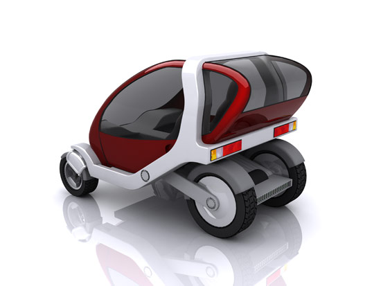
MIT CityCar
- Conceived by the Smart Cities group of MIT’
s Media Lab, CityCar is a stackable, two-passenger electric
vehicle for urban areas where users swipe a card and take
the first fully charged vehicle at any charging station.
Vehicles being returned are stacked and electrically
recharged. When folded and parked, CityCar is only five
feet long, and three to four cars can fit into a
traditional parking space. It is designed for
start-and-stop urban traffic, and the wheel robots allow
the car to spin on the spot. A sophisticated electronic
information and management system is envisaged to control
the supply and demand of cars in its network of sites.
Although the CityCar must still operate on congested urban
streets, the vehicle provides a non-polluting, noise-free,
energy-efficient, and convenient alternative to current
modes of short-distance travel.
After discussing this
example, ask students to identify some of the environmental
problems being addressed by this new system and concept.
Now break into design teams. Discuss the role of a
transportation planner in this design challenge. How can a
transportation planner use design to engineer and motivate
solutions that will impact your community and larger
region?
Talk about some of the potential solutions
that transportation engineers and designers are using
today:
• Planners can choose more
environmentally friendly materials for infrastructure
• Planners can be inclusive of pedestrians and
bicyclists when redesigning roadways
•
Planners can think more critically about multi-use
corridors and spaces that are not just for cars but also
people
• Livable streets -
planners can integrate road architecture that slows down
traffic and improves the quality of street life
• Buffer zones - planners can create
buffer zones with trees and native plants to absorb air
emissions and runoff areas that help to filter runoff from
road surfaces.
Each team will be presented with a scenario.
For example:
New York City
• Past
- NYC has been a leader in public transport for
centuries, but in the 1950s a man named Robert Moses
proposed many controversial road projects that fragmented
and transformed many NYC neighborhoods and landscapes.
• Present - NYC has nearly 9 million
residents. Subway, roads and pedestrian ways are at full
capacity, yet more people are expected to move to the
city’ s already crowded island. The city also has the
2nd poorest air quality in the country and very few
incentives for bicyclists or public transportation users.
• Future - How can NYC become more
bike-friendly; expand the capacity of its public
transportation system? How can the city reduce the number
of cars and commuters that clog its streets?
Birmingham, AL
• Past - Birmingham
used to be an industrial city with lots of trade. Many
roads however would flood because of major storms and the
their proximity to nearby rivers.
• Present
- Because of disrepair, many roads have large
potholes and roadways near the river basin have been
closed.
• Future: How can Birmingham reclaim
space along riverfronts around the city? Can native
plantings and ecological planning help? What would a
redesigned riverfront look like for bicyclists, pedestrians
or cars?
Sheldon, Ohio
• Past
- Sheldon was classically a farming town of 3, 500
residents. Most of the roads were state funded county roads
and farming byways.
• Present -
Sheldon’ s population has tripled in the past 20
years, now a suburban center outside of downtown Cleveland.
The city has not been able to plan for proper flow of
traffic, pedestrians or for bikes. Traffic jams, congestion
and many parking lots fill the city.
• Future:
Sheldon wants to make their city walkable and bike
friendly. What would a transportation plan look like to
help Sheldon achieve this?
Green City Design Lab:
Part Two (10 minutes - Edit and Develop)
Allow
each team to brainstorm, sketch and think through solutions
to their scenario. Encourage students to think about
historical and contemporary issues in transportation to
help them with their designs.
After brainstorming, allow
each team to draw on a larger piece of poster paper a map
and description of their transportation plan re-design.
Each team should present their ideas in addressing their
scenario to the class. If time permits, setup a community
board in the classroom to evaluate each design. (Share and
Evaluate)